![](/images/other/stat-length.png)
![Tocht Stappen Le Mung - Le vallon du Charenton - Photo](https://media.geolcdn.com/t/1900/400/ext.pjpeg?maxdim=2&url=https%3A%2F%2Fstatic1.geolcdn.com%2Fsiteimages%2Fupload%2Ffiles%2F1553511878bg_sport_marche.png)
Le vallon du Charenton
tupeutla
Gebruiker
![Lengte](/images/other/stat-length.png)
Lengte
8 km
![Max. hoogte](https://static1.geolcdn.com/siteimages/upload/files/1508320355ic_sort_altitude_max_24dp.png)
Max. hoogte
38 m
![Positief hoogteverschil](https://static1.geolcdn.com/siteimages/upload/files/1508320355ic_sort_den_pos_24dp.png)
Positief hoogteverschil
72 m
![Km-Effort](/images/other/stat-length.png)
Km-Effort
9 km
![Min. hoogte](https://static1.geolcdn.com/siteimages/upload/files/1508320355ic_sort_altitude_min_24dp.png)
Min. hoogte
4 m
![Negatief hoogteverschil](https://static1.geolcdn.com/siteimages/upload/files/1508320355ic_sort_den_neg_24dp.png)
Negatief hoogteverschil
72 m
![Boucle](https://static1.geolcdn.com/siteimages/upload/files/16400158638029165_repeat_loop_refresh_sync_direction_icon.png)
Boucle
Ja
Datum van aanmaak :
2018-06-26 14:10:56.698
Laatste wijziging :
2018-06-26 14:10:56.698
![Stappen](https://static1.geolcdn.com/sitytour/trail-icons/101.png)
2h00
Moeilijkheid : Heel gemakkelijk
![Scan deze QR-code om de tocht te openen in de SityTrail-applicatie](https://capi.geolives.com/qq0zvz2zws4bq2lad0pu/sitytour/trails/967904/qr.png?size=200)
Gratisgps-wandelapplicatie
Over ons
Tocht Stappen van 8 km beschikbaar op Nieuw-Aquitanië, Charente-Maritime, Le Mung. Deze tocht wordt voorgesteld door tupeutla.
Beschrijving
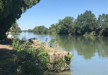
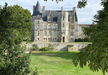
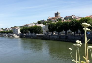
Jolie balade très ombragée au bord de l'eau. Bois, champs, jardins et beau bâti : Tout y est. Quelques passages boueux en périodes de pluie.
Plaatsbepaling
Land:
France
Regio :
Nieuw-Aquitanië
Departement/Provincie :
Charente-Maritime
Gemeente :
Le Mung
Locatie:
Unknown
Vertrek:(Dec)
Vertrek:(UTM)
679788 ; 5083266 (30T) N.
Opmerkingen
Wandeltochten in de omgeving
![Tocht Stappen Crazannes - Crazanne ... un joli circuit - Photo](https://media.geolcdn.com/t/375/260/ext.jpg?maxdim=2&url=https%3A%2F%2Fservices.sitytrail.com%2FGeolivesWS%2FDownloadMedia.ashx%3FTrailID%3D814687%26Media%3D20170821140832.jpg)
![Stappen Stappen](https://static1.geolcdn.com/sitytour/trail-icons/101.png)
Crazanne ... un joli circuit
Stappen
Heel gemakkelijk
(2)
Crazannes,
Nieuw-Aquitanië,
Charente-Maritime,
France
![](/images/other/stat-length.png)
10,6 km | 11,8 km-effort
3h 2min
![](https://static1.geolcdn.com/siteimages/upload/files/16400158638029165_repeat_loop_refresh_sync_direction_icon.png)
Ja
![Tocht Stappen Port-d'Envaux - Port d'Envaux/Crazannes n°2 - Photo](https://media.geolcdn.com/t/375/260/ext.jpg?maxdim=2&url=https%3A%2F%2Fstatic1.geolcdn.com%2Fsiteimages%2Fupload%2Ffiles%2F1553511878bg_sport_marche.png)
![Stappen Stappen](https://static1.geolcdn.com/sitytour/trail-icons/101.png)
Port d'Envaux/Crazannes n°2
Stappen
Medium
(1)
Port-d'Envaux,
Nieuw-Aquitanië,
Charente-Maritime,
France
![](/images/other/stat-length.png)
7,1 km | 7,9 km-effort
1h 47min
![](https://static1.geolcdn.com/siteimages/upload/files/16400158638029165_repeat_loop_refresh_sync_direction_icon.png)
Ja
![Tocht Elektrische fiets Taillebourg - Taillebourg -Rochefort 13/09/22 - Photo](https://media.geolcdn.com/t/375/260/b74ef137-f91b-494e-907f-0e6af7c7199f.jpg&format=jpg&maxdim=2)
![Elektrische fiets Elektrische fiets](https://static1.geolcdn.com/sitytour/trail-icons/205.png)
Taillebourg -Rochefort 13/09/22
Elektrische fiets
Medium
Taillebourg,
Nieuw-Aquitanië,
Charente-Maritime,
France
![](/images/other/stat-length.png)
56 km | 61 km-effort
4h 18min
![](https://static1.geolcdn.com/siteimages/upload/files/16400158638029165_repeat_loop_refresh_sync_direction_icon.png)
Neen
![Tocht Stappen Port-d'Envaux - port d'enveaux et ses châteaux - Photo](https://media.geolcdn.com/t/375/260/cb38a603-1de5-4a56-8e8b-0b145b5a46bf.jpg&format=jpg&maxdim=2)
![Stappen Stappen](https://static1.geolcdn.com/sitytour/trail-icons/101.png)
port d'enveaux et ses châteaux
Stappen
Heel gemakkelijk
Port-d'Envaux,
Nieuw-Aquitanië,
Charente-Maritime,
France
![](/images/other/stat-length.png)
5,5 km | 5,9 km-effort
2h 9min
![](https://static1.geolcdn.com/siteimages/upload/files/16400158638029165_repeat_loop_refresh_sync_direction_icon.png)
Ja
![Tocht Stappen Crazannes - crazannes, le château du chat botté et ses carrières - Photo](https://media.geolcdn.com/t/375/260/4fbd2bf6-d15e-41c7-8710-856e588c043c.jpg&format=jpg&maxdim=2)
![Stappen Stappen](https://static1.geolcdn.com/sitytour/trail-icons/101.png)
crazannes, le château du chat botté et ses carrières
Stappen
Heel gemakkelijk
Crazannes,
Nieuw-Aquitanië,
Charente-Maritime,
France
![](/images/other/stat-length.png)
6,4 km | 7 km-effort
1h 49min
![](https://static1.geolcdn.com/siteimages/upload/files/16400158638029165_repeat_loop_refresh_sync_direction_icon.png)
Ja
![Tocht Stappen Le Mung - BALLADE BORD CHATENTON à ST SAVINIEN 17 - Photo](https://media.geolcdn.com/t/375/260/ext.jpg?maxdim=2&url=https%3A%2F%2Fservices.sitytrail.com%2FGeolivesWS%2FDownloadMedia.ashx%3FTrailID%3D992439%26Media%3Dfix__20180624113356.jpg)
![Stappen Stappen](https://static1.geolcdn.com/sitytour/trail-icons/101.png)
BALLADE BORD CHATENTON à ST SAVINIEN 17
Stappen
Gemakkelijk
(1)
Le Mung,
Nieuw-Aquitanië,
Charente-Maritime,
France
![](/images/other/stat-length.png)
8,1 km | 9,1 km-effort
2h 14min
![](https://static1.geolcdn.com/siteimages/upload/files/16400158638029165_repeat_loop_refresh_sync_direction_icon.png)
Ja
![Tocht Stappen Crazannes - crazannes - Photo](https://media.geolcdn.com/t/375/260/8dec554d-fce3-4434-bb84-8b65c08b7906.jpg&format=jpg&maxdim=2)
![Stappen Stappen](https://static1.geolcdn.com/sitytour/trail-icons/101.png)
crazannes
Stappen
Medium
Crazannes,
Nieuw-Aquitanië,
Charente-Maritime,
France
![](/images/other/stat-length.png)
8,5 km | 9,2 km-effort
3h 3min
![](https://static1.geolcdn.com/siteimages/upload/files/16400158638029165_repeat_loop_refresh_sync_direction_icon.png)
Ja
![Tocht Stappen Taillebourg - Brizanbourg - Photo](https://media.geolcdn.com/t/375/260/d617646a-eb73-4c6a-97e4-91baa2c07b3a.jpg&format=jpg&maxdim=2)
![Stappen Stappen](https://static1.geolcdn.com/sitytour/trail-icons/101.png)
Brizanbourg
Stappen
Heel gemakkelijk
Taillebourg,
Nieuw-Aquitanië,
Charente-Maritime,
France
![](/images/other/stat-length.png)
10,2 km | 11,6 km-effort
2h 33min
![](https://static1.geolcdn.com/siteimages/upload/files/16400158638029165_repeat_loop_refresh_sync_direction_icon.png)
Neen
![Tocht Te voet Port-d'Envaux - SityTrail - 2198546 - port-dxenvaux-8x8-kms - Photo](https://media.geolcdn.com/t/375/260/0e2afbbe-4791-4a0e-a941-e25e73119819.jpg&format=jpg&maxdim=2)
![Te voet Te voet](https://static1.geolcdn.com/sitytour/trail-icons/100.png)
SityTrail - 2198546 - port-dxenvaux-8x8-kms
Te voet
Heel gemakkelijk
Port-d'Envaux,
Nieuw-Aquitanië,
Charente-Maritime,
France
![](/images/other/stat-length.png)
9 km | 9,7 km-effort
Onbekend
![](https://static1.geolcdn.com/siteimages/upload/files/16400158638029165_repeat_loop_refresh_sync_direction_icon.png)
Ja